
Geodata-Based Coastal Environment in Unreal Engine
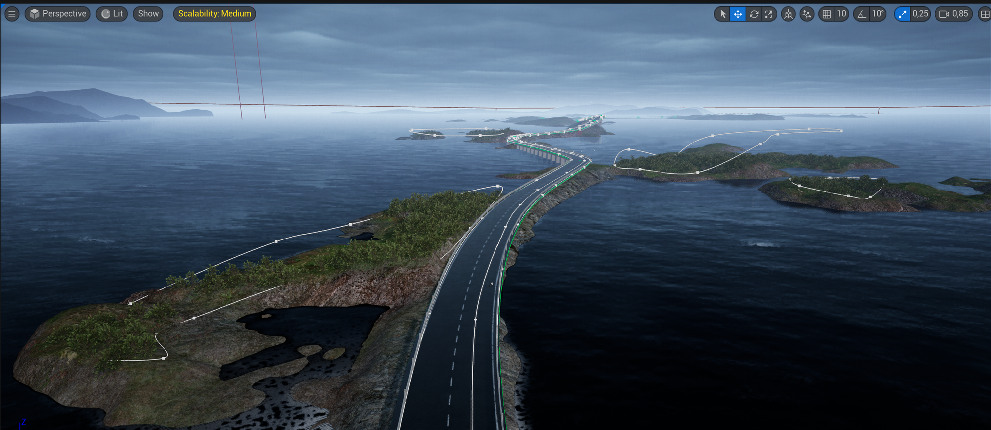
This project began as a visualization study exploring how government landscape/elevation data could be brought into Unreal Engine. The terrain is based on real geodata from the Atlantic Ocean Road coastal area in western Norway. To make the environment more complete and readable as a 3D scene, I manually added approximate road and bridge elements as contextual infrastructure.
The current focus of the project is to demonstrate a geodata-to-Unreal workflow: transforming real terrain data into an interactive environment, distinguishing between source-data-derived terrain and manually authored scene elements, and preparing the environment for future visualization, simulation, or terrain-analysis use cases.
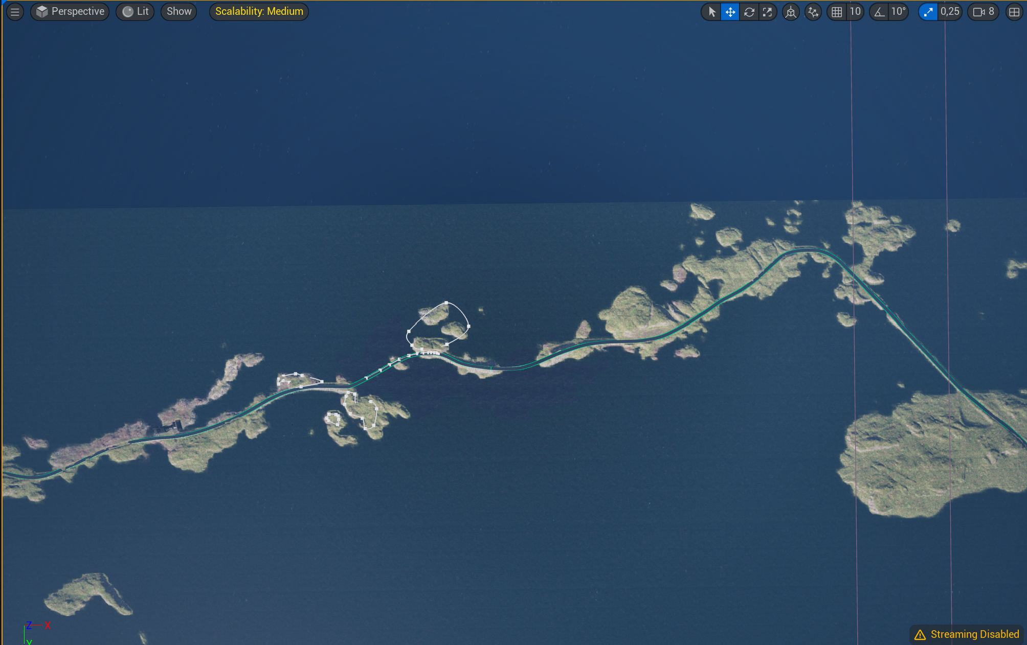
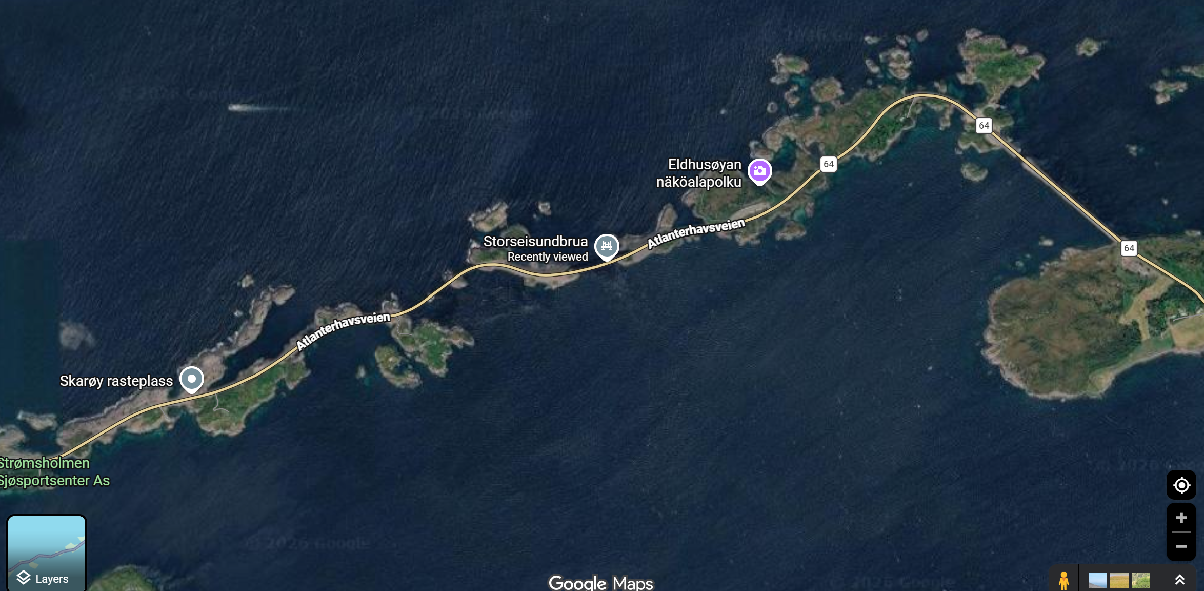
UE environment compare with Goole Map:
Landscape
In the process of crafting a virtual landscape, I leveraged Geographic Information System (GIS) data sourced from Kartverket in Norway. This data served as the foundation for my project.
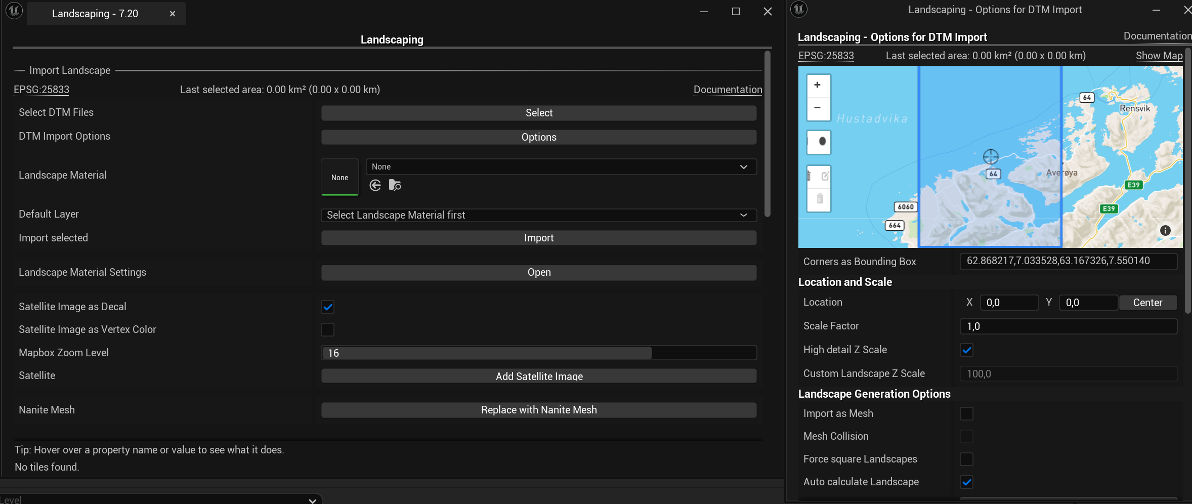
Importing DTM Files with a Landscaping Plugin:
I utilized the plugin "Landscaping" that allowed me to seamlessly import Digital Terrain Model (DTM) files. The DTM files provided elevation data, which formed the basis for constructing the landscape.
Contextual road and bridge
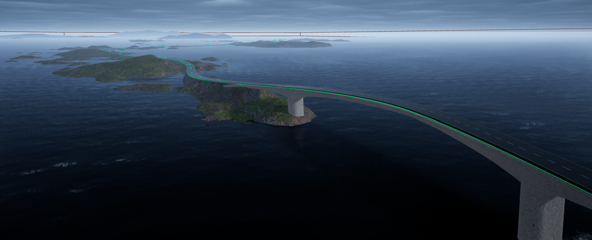
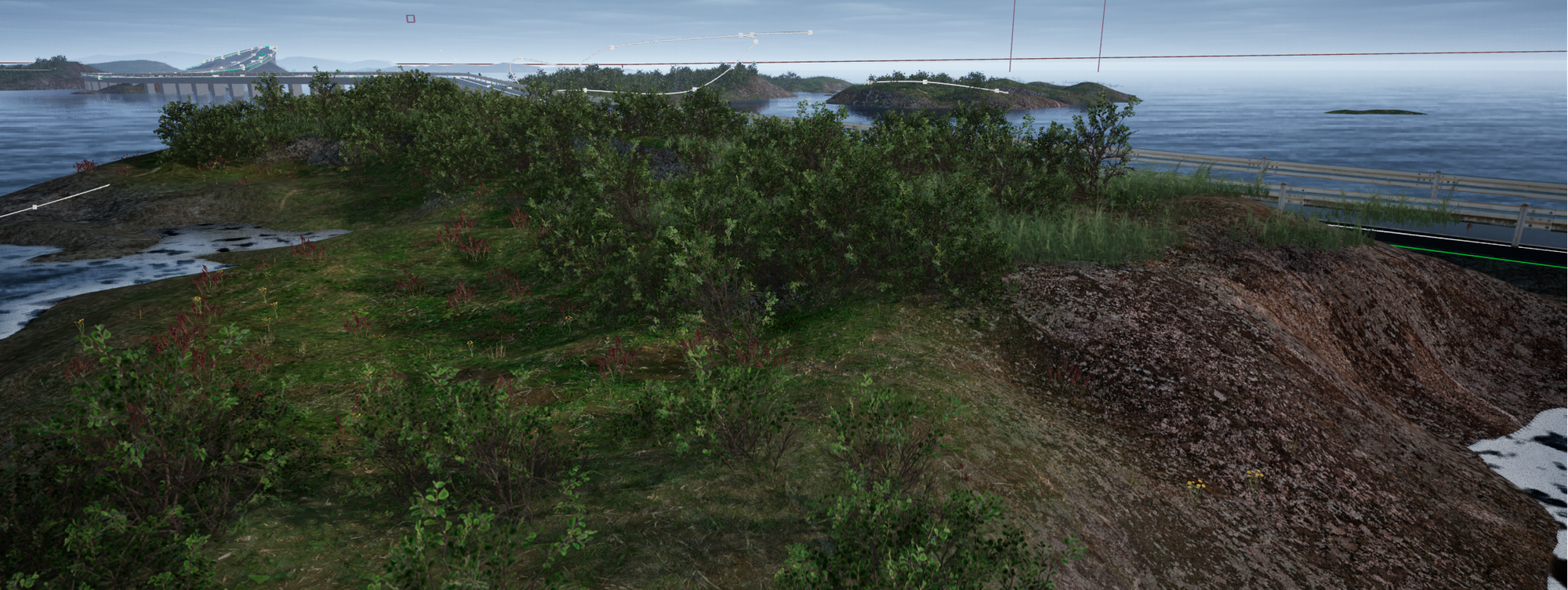
The terrain was generated from DTM elevation data, while the road and bridge were manually added as contextual infrastructure. The road was built in Unreal Engine using a Landscape Spline Actor and a modular road section modelled in Blender, measuring approximately 4 m in length and 4 m in width. It was aligned with the visible road trail on the terrain. The bridge was also modelled in Blender based on reference pictures and placed into the scene to improve the environment’s readability, context, and usability.
Material Creation Using Automatic Landscape Materials
I used an automatic landscape material system to assign different surface materials based on terrain characteristics. The material system separates flatter areas from steeper slopes, allowing the landscape to respond visually to changes in terrain form. This helped create a more natural terrain appearance and reduced the need for manual material painting across the full landscape.
Foliage Implementation using Procedural Content Generation (PCG):
Foliage was implemented using Unreal Engine’s Procedural Content Generation system. One PCG setup was used to distribute grass across the terrain based on landscape conditions such as height and surface placement. This allowed vegetation to be generated dynamically instead of being placed manually.
A second PCG setup used spline-based placement to control foliage in specific areas of interest. This made it possible to guide vegetation along selected paths or regions, giving more artistic and spatial control while still keeping the workflow procedural.
The other two plugins that I used for the landscape are Cinematic Ocean and Ultra Dynamic Sky, which helps me a lot to enhance the atmosphere.
In summary, this is a geodata-to-Unreal coastal environment project using DTM elevation data for terrain generation, reference-based road and bridge reconstruction, automatic landscape materials, and PCG foliage to create a structured Unreal scene. It serves a foundation for future simulation or analysis development.